| Camp Plauche: Pictures and History Harahan, Louisiana |
| Located on the western outskirts of New Orleans, near the Huey P. Long Mississippi River bridge, in Jefferson Parish, Camp Plauche was originally known as Camp Harahan. It was renamed in honor of Major Jean Baptiste Plauche, who served under Andrew Jackson at the Battle of New Orleans. Major Plauche went on to become the second Lt. Governor of Louisiana under the administration of Gov. Joseph Walker. They were the first elected officials to be sworn in at the new State Capitol in Baton Rouge, in June of 1850. During World War II, Camp Plauche was, first, a staging area for troops, then, an Army training facility and, later on, a POW camp for German and Italian prisoners. At first, the camp served as a staging area for troops passing through the New Orleans Port of Embarkation; then it was turned into a training base. It was at Camp Plauche that the 765th Transportation Battalion was formed. Between 200,000 - 300,000 troops were organized and trained there. It functioned as the Transportation Corps Training Center and the Transportation Corps Officer Candidate School. It was also an important Animal Remount Station (point of embarkation and debarkation for Army horses and mules; thousands came through Camp Plauche on their way to the Pacific and European Theaters). Camp Plauche had 610 housing units and a hospital. After the war, the base hospital, which was located on the river side of Jefferson Highway, became the first Ochsner Foundation Hospital. Later on, a new Ochsner Hospital was built further down on Jefferson Highway. With training needs on the wane, Camp Plauche became a prisoner of war camp. Three thousands Italian prisoners were held there and all the rest were German prisoners, mainly from Gen. Rommel's "Afrika Korps." C. J. Christ, columnist for Houma Today, writes, "The Camp Plauche paper contained a lengthy description of the nearby Huey P. Long Bridge over the Mississippi River, the towering sight and sounds of which would last forever in the memories of the POW's encamped there." Mr. Christ, also, mentions his grandfather clearing sugar cane and weeds on the site in preparation for building the Army barracks, saying that his grandfather remembered most of all the sounds of the chugging and puffing steam engines, as they climbed to the top of the steep Huey P. Long bridge. From war's end until the mid-1950's, the barracks were used as apartments for veterans. With a significant housing shortage throughout the city, the barracks-turned-apartments were eagerly sought-after. My own family lived in one of those apartments briefly in the early 1950's (pictures below). Ultimately, all of the former camp's buildings were torn down, but the salvaged building materials went into many homes in the area. Camp Plauche lives on - sometimes in the least expected places! Construction on Elmwood Industrial Park began on Camp Plauche's former site in the 1960's. There are now hundreds of offices, manufacturing plants and storage facilities located there. There's nothing left to indicate that the area was once a critical training facility, a prisoner of war camp or home to hundreds of GI's families. But, sometimes in the quiet of the night, you could almost swear that you hear the faint sounds of a chugging steam engine and the far-off whistle of its horn. -- Nancy |
| Army Staging Area - Army Training Base - Prisoner of War Camp - Apartment Complex for Veterans - Elmwood Industrial Park now occupies the land once used for Camp Plauche. |
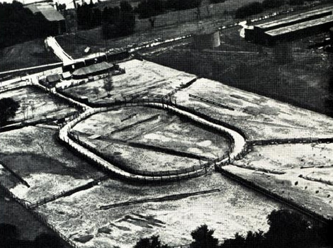
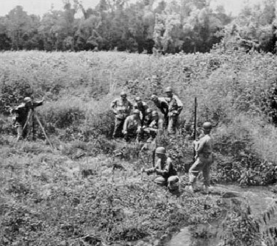
| Camp Plauche as it looked during its days as an Army training base. |
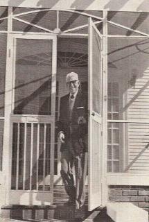
| Aerial view of Animal Remount Station at Camp Plauche, 1944; loading wharf is shown in upper left corner. |
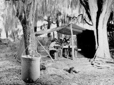
| Malaria survey unit's field laboratory, training exercises, WWII, Camp Plauche. |
| Malaria control unit, Unit Training Center, Camp Plauche. |
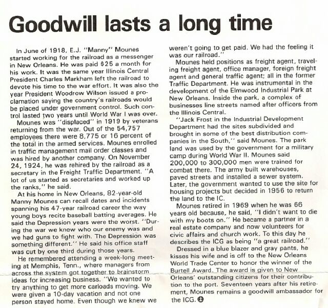
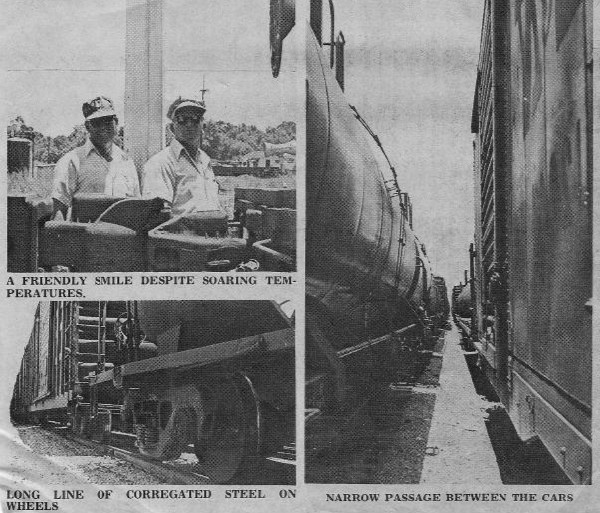
| E. J. "Manny" Mounes, One of the Developers of Elmwood Industrial Park ~ and ~ Goodwill Ambassador for the Illinois Central Gulf Railroad |
| With special thanks to Fred Bullinger for sharing the articles below with us. |
| Back to Old New Orleans Whispers - Home |
| Also, thanks to Fred Bullinger . . . |
| Images above and article below are from a 1975 East Bank Guide. |
| "A map of East Jefferson from Civil War days indicates about 100 houses nestled along the Mississippi River and a bold straight line cutting across the center of the parish. The line is the railroad. |
| "The cities of Harahan and Kenner owe their early existence to the railroads, and now, much of the metropolitan area, including the Elmwood Development on the East Bank of Jefferson, depends on tankcars, boxcars and flatcars for the commerce that helps the area thrive. |
| "One of the busiest sections of track is Mays Yard near Central Avenue, where trains switch tracks as they are channeled through New Orleans, over the Huey P. Long Bridge and into the Port of New Orleans. |
| "The cinders, red and green lights, wooden crossties and other familiar railroad sights that are part of the childhood of most Americans are in Mays Yard, along with the friendly faces of the engineer and the man in the caboose." |