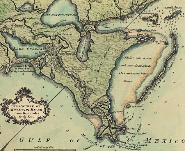
Labeled "Course of the Mississippi RIver," this map was, also, published under the
name, "A Map of the River Mississippi, Bayagoulas to the Sea." Louis Brion de la
Tour, who created the map, was an engineer who lived in Paris and held the post of
Ingenieur-Geographe du Roi (Engineer-Geographer of the King). He published a
number of atlases and a wide range of stastistical works in the mid-to-late 1700's. It is
believed that this map was drawn at least 30 years before it was published in 1759-61.
The Bayougoulas were Native Americans who lived along the banks of the
Mississippi River. Their name derived from the Choctaw language, meaning "bayou
people." After the French arrived in Louisiana, the Bayougoulas and other
Muskogean-speaking tribes lost their separate identities and eventually all became
known by the Europeans as the Houma Indians.
Though it's too small to decipher in the image above, there's an indication of the
location of Fort La Boulaye (see the right bank of the Mississippi, just under Lake
Borgne). It was here, in 1700, that Pierre Le Moyne d'Iberville and his brother,
Bienville, established the first European settlement in what is now Louisiana.
Sometimes referred to as Mississippi Fort, it was abandoned seven years later. In
1933, the remains of Fort La Boulaye were discovered in present-day Plaquemines
Parish.
| A Map of the River Mississippi: Bayagoulas to the Sea 1730 |
| The link to this page is: http:old-new-orleans.com/Course.html Back to Old New Orleans The Past Whispers - Home Blog: Historic New Orleans |